
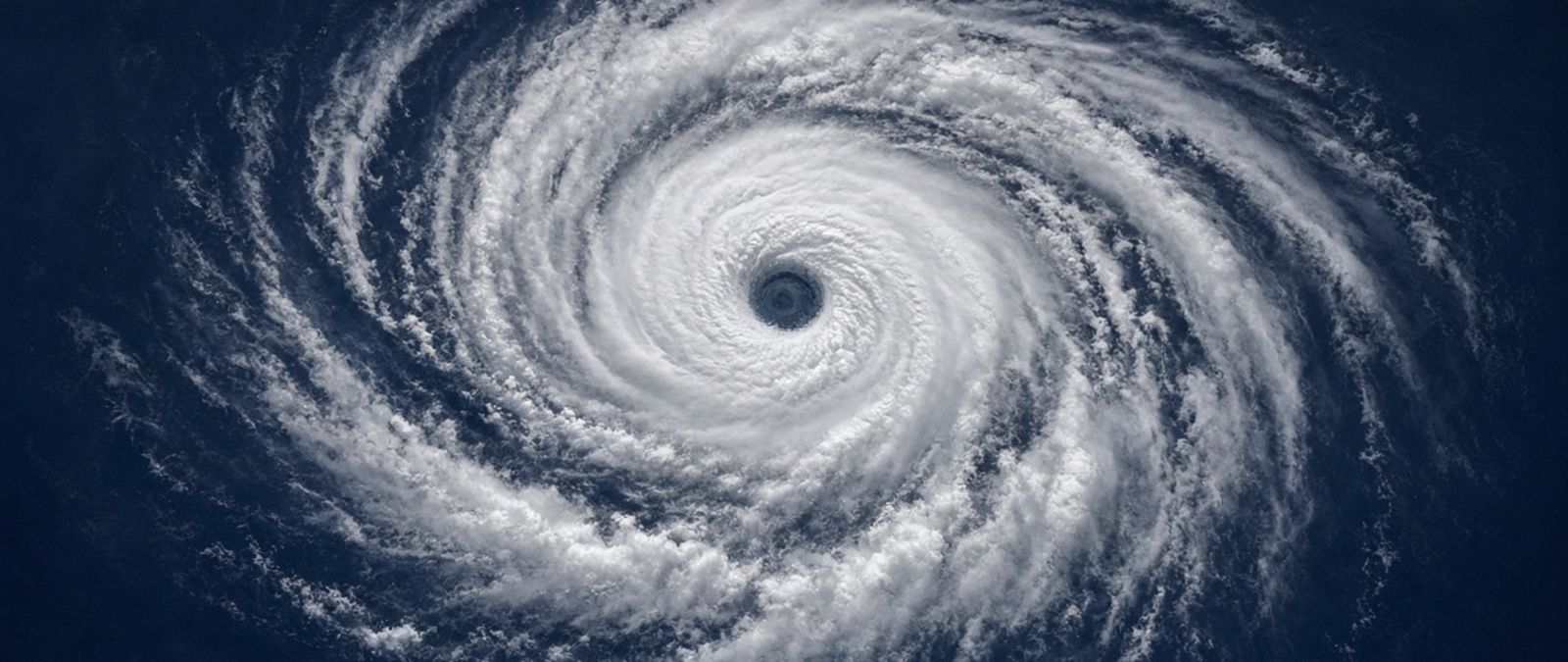
Cyclone Arnab reaches the coast of Andhra Pradesh and wrecks plantations and power lines, Telangana declares drought across hundreds of sub-districts, a global report ranks India among the countries most exposed to heatwaves, hail strikes south-east Queensland and the UK prepares for calmer, foggier days after two deadly storms.
Cyclone Arnab makes landfall in Andhra Pradesh and damages crops and power lines
Cyclone Arnab made landfall on the coast of the Indian state of Andhra Pradesh on Wednesday, bringing heavy rain and causing extensive damage in some areas, state officials said. Prakhar Jain, head of the state’s disaster management authority, said the storm weakened slightly before reaching land, with winds of up to 84mph, and that no casualties had been reported from the landfall while damage was assessed. The India Meteorological Department later downgraded it to a severe cyclonic storm.
Officials said Konaseema district was the worst hit, with banana and coconut plantations damaged and about 6,000 electricity poles uprooted, cutting power across the district. Fallen trees blocked roads and low-lying parts of the port city of Visakhapatnam flooded. In neighbouring Jharkhand, authorities in Ranchi and East Singhbhum closed schools on 28 and 29 October, and the weather service expected heavy rain and strong winds to continue in coastal Andhra Pradesh and southern Odisha.
Arnab formed in the Bay of Bengal and was named on 26 October, becoming the first cyclone of the 2026 North Indian Ocean season. Before it arrived, at least 89,000 people were evacuated in Andhra Pradesh, where more than 12 million live along the expected path; authorities opened more than 2,000 shelters across 20 districts and secured over 30,000 fishing boats. Odisha planned to move about 48,000 people. Earlier, a man died in Visakhapatnam after touching a fallen live wire.
Telangana declares drought in 365 mandals after a weak monsoon
The government of the Indian state of Telangana on Tuesday declared 365 mandals, or sub-districts, in 31 of its 33 districts to be affected by drought and told district authorities to begin relief measures without delay. Severe drought was declared in 111 mandals and moderate drought in 254. The notification will stay valid for six months, according to an order from Chief Secretary Sanjay Jaju, and follows a recommendation made by a cabinet sub-committee on 23 October.
The order provides for input subsidies paid directly to farmers, more drinking water, fodder and cattle camps where needed, and job creation under a rural employment scheme. District collectors are also to seek restructured farm loans and a halt to coercive loan recovery through the state-level bankers’ committee, within Reserve Bank of India guidelines. Deputy Chief Minister Mallu Bhatti Vikramarka was due to hold an all-party meeting on Wednesday to gather proposals on handling the dry conditions.
The government said the south-west monsoon was weakened by strengthening El Niño conditions, feeble low-pressure systems over the Bay of Bengal and long dry spells. The state received 615.5 mm of rain between 1 June and 30 September against a normal 740.6 mm, a shortfall of 17 per cent, and the area under paddy shrank by 18 per cent. Telangana, whose capital is Hyderabad, became a separate state in 2014. Gujarat recently declared four districts drought-hit for similar reasons.
India among the countries where infants and older people face the most heatwaves
Infants and older adults in India face some of the highest heatwave exposure in the world, as do those in China, Russia and the United States, the Lancet Countdown on Health and Climate Change said in its tenth indicator report. The authors, led by researchers at University College London, found that 2025 was the second-highest year on record for heatwave exposure of the two groups combined, after a record in 2024, and warned that the overall trend remained worrying.
Older adults worldwide experienced about 10.8 billion person-days of heatwaves in 2025 and infants 1.1 billion, down from 15.3 billion and 2.3 billion the year before. On average, each older adult faced 12.8 heatwave days and each infant 8.7. Heat was linked to an estimated 710,000 deaths in 2023, the hottest year of the 2016 to 2025 period, and the report attributed 71.5 per cent of them to climate change, more than the toll from malaria or HIV.
Marina Romanello, executive director of the Lancet Countdown, said the health harms of climate change were growing faster than the world’s response, despite progress in clean energy and health system readiness. The authors called for climate change to be formally declared a global health emergency, with a new instrument under the World Health Organization, and for health funding to be given as grants rather than loans. They estimated almost 3 million heat deaths linked to climate change between 2016 and 2023.
Golf ball-sized hail and lightning strike south-east Queensland
A supercell storm dropped golf ball-sized hail on parts of south-east Queensland on Tuesday afternoon, covering gardens on the Gold Coast so thickly that residents compared the scene to snow. Hailstones of up to 7 centimetres damaged cars in Mudgeeraba, and in Ipswich the suburbs of Augustine Heights and Redbank Plains were turned white. The storm passed within minutes but left more than 1000 homes without electricity, and residents shared videos of the hail online.
The same supercell crossed Brisbane Airport, where lightning struck the western runway shortly before 3pm. The runway was still closed at 6pm while engineers assessed the damage and worked out how to repair it. An airport spokesperson said the work would be finished overnight and the runway would be back in use by Wednesday morning, and passengers were warned to expect delays while operations returned to normal.
A supercell is a thunderstorm with a mesocyclone, a deep updraught that keeps rotating. Of the four main kinds of thunderstorm, supercells are the least common but can be the most severe, often producing large hail, torrential rain, strong winds and downbursts. Eastern Australia is among the regions where they form, along with parts of the United States, Argentina, Bangladesh, eastern India and South Africa. In the largest storms their clouds can tower up to 70,000 feet above the ground.
Calmer but foggy weather forecast for the UK after Storms Austen and Boelo
The Met Office said the UK would see a sharp change in its weather over the next 48 hours as high pressure replaces the low-pressure systems behind Storms Austen and Boelo. Forecaster Craig Snell said Wednesday would remain blustery with scattered showers before winds eased in the evening, but warned that dense, slow-clearing fog could disrupt morning journeys from Thursday in southern and central parts of the country.
Much of England and Wales is expected to stay dry into early November, though weather fronts may still bring rain to Scotland and Northern Ireland, and daytime temperatures should be near or slightly above average at around 12C to 16C, the forecaster said. Coastal residents were urged to watch for flooding, and a yellow flood risk remained for northern mainland Scotland and the Northern Isles through Wednesday after the Scottish Government’s resilience committee met.
Three people died during the spell of wind and rain that began last Thursday: two men killed by falling trees on Sunday, in north London and in Dumfries and Galloway, and a woman pulled from the sea off the Isle of Wight. Austen, named on 20 October as the first storm of the season, hit Cornwall and Wales hardest, while Boelo struck Scotland, Northern Ireland and northern England. Power cuts affected 838,700 properties during the two storms.