
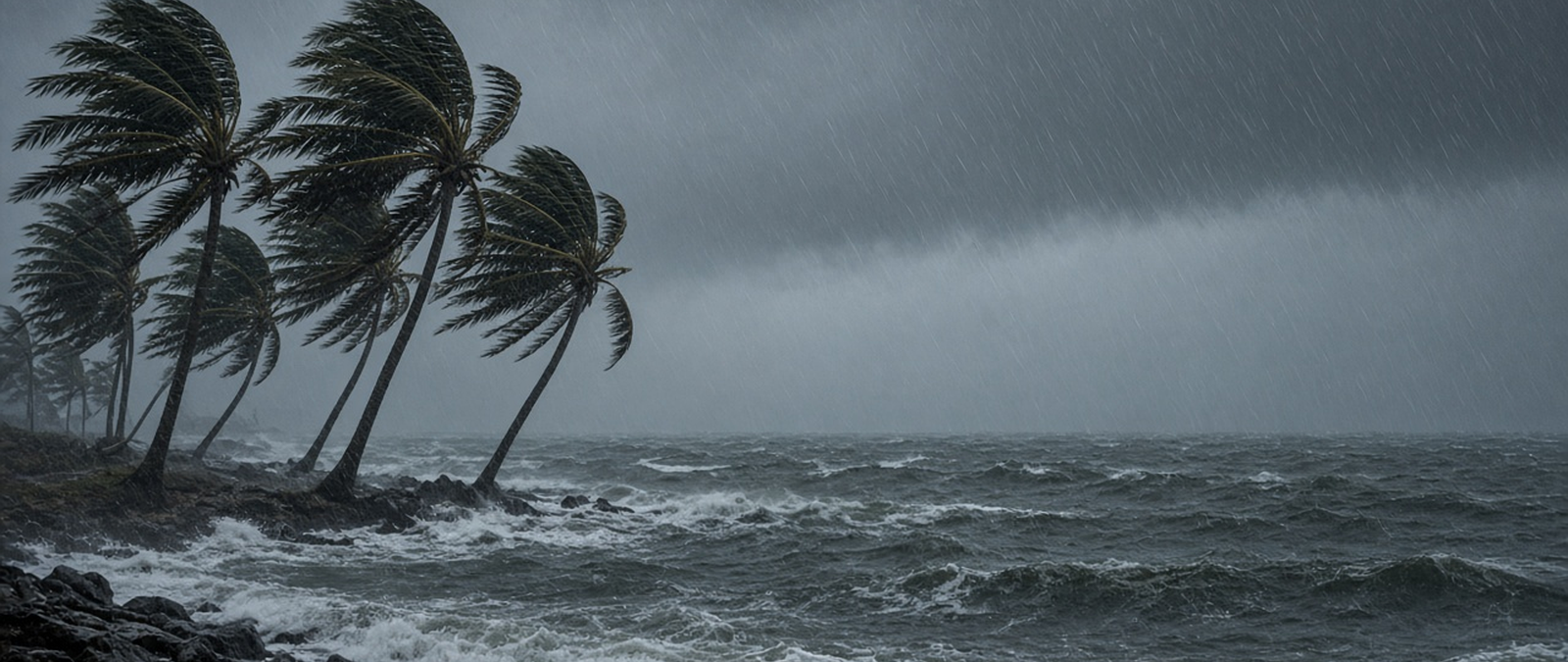
Two powerful storms are active on either side of the Pacific, with Super Typhoon Champi passing Guam and Hurricane Trudy drenching western Mexico. India has issued rain alerts for Kerala, Spain has raised a red warning for Valencia, the Cook Islands are bracing for a cyclone and Maharashtra faces anger over drought relief.
Super Typhoon Champi moves past Guam as Hurricane Trudy batters Mexico’s Pacific coast
Super Typhoon Champi was heading away from Guam on Sunday after skirting the southern tip of the island with sustained winds of about 240 kilometres an hour, the US National Weather Service said. By late Sunday afternoon the storm lay roughly 320 kilometres west of Guam and was tracking west at around 23 kilometres an hour, and forecasters said it could reach the strongest category, a Category 5 super typhoon, early on Monday local time. A typhoon warning stayed in force for Guam and Rota, while warnings for Tinian and Saipan were lifted. The governors of Guam and the Northern Mariana Islands asked for emergency disaster declarations on Friday, and on Saturday President Donald Trump approved one for Guam, allowing the Federal Emergency Management Agency to coordinate federal relief. Airports, harbours and some health facilities across the territories were closed, and the agency said outside help could take three to five days to arrive.
On the other side of the ocean, Hurricane Trudy brought heavy rain and strong winds to parts of Mexico’s Pacific coast on Sunday, and the US National Hurricane Center warned of flooding and mudslides that could put lives at risk, especially on steep ground. The stretch of coast between Manzanillo, in Colima, and Cabo Corrientes, in Jalisco, remained under a hurricane warning. Recent readings placed the Category 2 storm about 215 kilometres south-south-west of Cabo Corrientes, with maximum sustained winds near 165 kilometres an hour, moving north-west at about 17 kilometres an hour. Its centre was expected to stay close to the coast into Sunday evening before passing south of the Baja California peninsula. Forecasters expected 10 to 20 centimetres of rain over the weekend, with isolated totals near 30 centimetres in Michoacán, Colima and Jalisco. The Mexican navy urged mariners and coastal residents to take extreme care, and Colima officials warned that ground already soaked by earlier storms could worsen the damage.
Champi is the latest system in a busy 2026 western Pacific season, which has so far produced 30 named storms, 13 of them typhoons, with more than 350 deaths and damage above $10.4 billion, according to the season’s public record. The Japan Meteorological Agency first reported a tropical depression near Micronesia on October 11. It named the system Champi on October 15 and raised it to a severe tropical storm and then to a typhoon on October 16, when the US Joint Typhoon Warning Center said it had begun to strengthen rapidly. By October 17, as it approached Guam, its one-minute sustained winds had reached about 220 kilometres an hour. The Mariana Islands are still recovering from two earlier super typhoons this year, Sinlaku in April and Bavi in July. Sinlaku remains the most intense storm of the season, with ten-minute sustained winds of 215 kilometres an hour and a lowest pressure of 905 hectopascals.
India’s weather service issues five-day heavy rain alert for districts across Kerala
The India Meteorological Department has placed several districts of the southern state of Kerala under a yellow alert, forecasting isolated spells of heavy rain across the state over the next five days. According to the department’s bulletin, a yellow alert signals that between 64.5 and 115.5 millimetres of rain could fall in a single 24-hour period in the areas concerned. The warning covers most of the state at some point during the period from Sunday, October 18, to Thursday, October 22, with the list of districts shifting from day to day as the rain bands move. Disaster management authorities have advised people living in vulnerable and low-lying places to stay alert, because short bursts of heavy rain could cause temporary waterlogging and local disruption to daily life, traffic and services. Residents have been told to follow official updates as the forecast is revised during the week.
On Sunday the alert applies to six northern and central districts: Palakkad, Malappuram, Kozhikode, Wayanad, Kannur and Kasaragod. On Monday it moves to Pathanamthitta, Kottayam, Idukki, Ernakulam, Malappuram, Wayanad and Kannur. On Tuesday the southern part of the state is the focus, with Thiruvananthapuram, Kollam, Pathanamthitta, Alappuzha, Kottayam, Idukki and Ernakulam listed. The widest coverage comes on Wednesday, when ten districts are included: Thiruvananthapuram, Kollam, Pathanamthitta, Alappuzha, Kottayam, Idukki, Ernakulam, Thrissur, Palakkad and Malappuram. On Thursday the alert shifts north again to Idukki, Ernakulam, Thrissur, Palakkad, Malappuram, Kozhikode, Wayanad and Kannur. Idukki and Ernakulam appear on four of the five days, the most of any district in the bulletin. Kasaragod, in the far north of the state, is named only on the first day, while the capital, Thiruvananthapuram, is listed on Tuesday and Wednesday.
The India Meteorological Department is the national agency responsible for weather observation, forecasting and seismology, and it operates under the Ministry of Earth Sciences. It was formed on January 15, 1875, and has its headquarters in Delhi, with regional offices in Chennai, Mumbai, Kolkata, Nagpur, Guwahati and New Delhi and hundreds of observation stations across India and Antarctica. The department is one of six regional specialised meteorological centres of the World Meteorological Organization, and it is in charge of forecasting, naming and issuing warnings for tropical cyclones across the northern Indian Ocean, including the Bay of Bengal, the Arabian Sea, the Strait of Malacca and the Persian Gulf. Scientific interest in the Indian monsoon goes back centuries, and the astronomer Edmond Halley published a study of it in 1686. The first observatories in India were set up by the East India Company, in Calcutta in 1785 and in Madras in 1796.
Spain issues red alert in Valencia as Storm Adam threatens up to 400mm of rain
Spain’s national weather agency, AEMET, has issued its highest-level red warning for the southern coast of the Valencia region and the northern coast of Alicante, as a weather system named Adam threatens torrential and persistent rain. The warning took effect at 10am on Sunday, with the agency forecasting up to 400 millimetres of rain over 24 hours in some places and 200 millimetres over 12 hours, as well as local downpours of 90 millimetres in a single hour north-west of Gandia. Accumulations of 300 to 400 millimetres are possible along that coast between Sunday and Monday. Temperatures are expected to drop sharply, with highs no greater than 19 degrees in Castelló, 20 in Valencia and 23 in Alicante, while strong northerly gusts are forecast along the Gulf of Valencia. Warnings are also in force in Catalonia, Murcia, Andalusia, Extremadura and the Balearic Islands.
The storm has already caused harm in Catalonia, where emergency services were searching for a woman believed to have fallen into a flooded watercourse in Cabrera de Mar, a town in the Maresme area north of Barcelona. Firefighters worked through Saturday night and into Sunday, supported by the regional police, local officers and maritime rescue teams, with nine units taking part. Elsewhere in the province of Barcelona, crews rescued people trapped in cars and flooded buildings. Authorities have asked residents in the affected regions to avoid unnecessary travel, never to drive through floodwater however shallow it looks and to keep away from rivers, ravines and normally dry riverbeds, which can turn into torrents within minutes. Officials stress that conditions can vary a great deal between neighbouring towns and that local warnings should be followed closely. The national emergency number is 112.
Adam is what Spanish forecasters call a DANA, an isolated depression at high levels that forms when a pocket of cold air breaks away from the main atmospheric flow. When that cold air meets warm, moist air from the Mediterranean, it can produce storms that stay over the same area for hours. Such a system caused the floods of October 29, 2024, when torrential rain brought more than a year’s worth of precipitation to parts of eastern Spain, including the Valencian Community, Castilla-La Mancha and Andalusia. Those floods killed about 241 people and caused an estimated 10.7 billion euros in total damage, making them one of the deadliest natural disasters in Spanish history. The regional and national response was widely criticised, and in November 2025 the then president of the Valencian Community, Carlos Mazón, announced his resignation. An earlier cold-drop flood in 1957 overflowed the Turia river and killed at least 81 people in Valencia.
Cook Islands prepare for Tropical Cyclone Wati as Aitutaki opens emergency centre
Aitutaki, in the southern Cook Islands, has opened its emergency operations centre ahead of the arrival of Tropical Cyclone Wati, the island council said. The storm, a Category 2 system, is moving south-east towards the southern group, and conditions are expected to worsen over the coming days. The Cook Islands Meteorological Service said the storm was travelling south to south-east at about 16 kilometres an hour and was about 290 kilometres north of Palmerston at 2pm local time, with sustained winds of up to 91 kilometres an hour near its centre and gusts of 130 kilometres an hour. For Aitutaki and the three islands known as Ngaputoru, which are Mauke, Mitiaro and Atiu, the service forecast fresh to strong winds with gusts of 80 kilometres an hour, rising to damaging gales averaging about 95 kilometres an hour from Sunday. Heavy rain, squally thunderstorms and very rough seas are also expected.
John Strickland, director of Emergency Management Cook Islands, said Aitutaki was well prepared and that its council, led by the mayor together with a government executive officer, was ready for whatever arrived, possibly overnight or the following morning. Schools on the island have been organised, and a maintenance team, police, the water authority, the Red Cross and other agencies are on standby. Strickland said forecasters expected Wati to pass between Mauke, Mitiaro and Atiu. Nathan Tism of the Meteorological Service said the country had been fortunate to identify the system while it was still a tropical depression, which allowed warnings to go out before it strengthened, and that its early track to the south had crossed no inhabited islands. The service has issued its final special bulletin for the northern Cook Islands, and Tism said Wati should weaken into a low by about Monday as it leaves Cook Islands waters.
Aitutaki is the second most populous island in the Cook Islands after Rarotonga, with 1,782 residents recorded in 2021, and it is also the country’s second most visited island and a major tourist destination. It is often described as an almost atoll: a main island with an area of high ground, surrounded by a reef and a lagoon dotted with fifteen smaller islets. Its total land area is a little over 18 square kilometres, while the lagoon covers between 50 and 74 square kilometres depending on how the reef flat is measured. The highest point, a hill called Maunga Pu near the northern end, rises to about 123 metres. The main village, Arutanga, lies on the west coast. The barrier reef that encloses the lagoon is shaped roughly like a triangle with sides of about 12 kilometres. The main island itself covers about 16.8 square kilometres, and the Ootu Peninsula reaches out from it along the eastern rim of the reef.
Maharashtra farmers protest over drought payment as state widens declared drought area
Farmers from the drought-hit Dharashiv district of the Indian state of Maharashtra have sent Rs 5,000 by money order to Chief Minister Devendra Fadnavis in protest at the size of the state’s first relief payment. Fadnavis had announced that each eligible farmer would receive an advance of at least Rs 5,000, paid directly into bank accounts before the Diwali festival, with further compensation to follow. He also said drought had now been declared in 305 talukas, the state’s local administrative units, up from 265 earlier. Speaking in Wardha on October 17, the chief minister described the payment as unprecedented, saying farmers had never before received such help ahead of December and that smallholders had previously been given barely Rs 1,000. He acknowledged that the sum could not cover their losses but said it would bring some relief, and added that loan waiver payments were also being credited.
The protest came from farmers in Surdi village, who posted the money order on Thursday. Balaji Fawade, who grows soybean on five acres, said harvesting his crop alone would cost Rs 25,000, five times the relief payment, and that selling the harvest would not cover that expense. His neighbour Chand Shaikh said he had spent Rs 25,000 on his plot of 1.5 acres, harvested just 60 kilograms and earned only Rs 3,900, and that he had borrowed Rs 1,100 to pay for the money order. Kailash Patil, a legislator from Dharashiv for the Shiv Sena faction led by Uddhav Thackeray, said the amount would not even cover the cost of the festival, pointing to the price of cooking oil and gas. Fadnavis rejected the criticism, comparing the payment with the Rs 2,500 given in neighbouring Karnataka and with his government’s Ladki Bahin cash scheme for women, which opponents had also called too small.
Dharashiv, formerly known as Osmanabad, is a mainly rural district in the Marathwada region in the south of Maharashtra, with its headquarters in the town of Osmanabad. The earlier name came from Mir Osman Ali Khan, the last Nizam of Hyderabad, whose state included the region until India’s independence in 1947. The district covers about 7,569 square kilometres on the Deccan plateau at an altitude of roughly 600 metres, and parts of the Sina, Manjira and Terna rivers flow through it. At the 2011 census it had about 1.66 million inhabitants, of whom fewer than 17 per cent lived in urban areas. It borders the districts of Beed, Latur, Solapur and Ahmednagar in Maharashtra and the Bidar and Kalaburagi districts of Karnataka. Its administrative subdivisions include Osmanabad, Tuljapur, Omerga, Lohara, Kalamb, Bhoom, Paranda and Washi.