
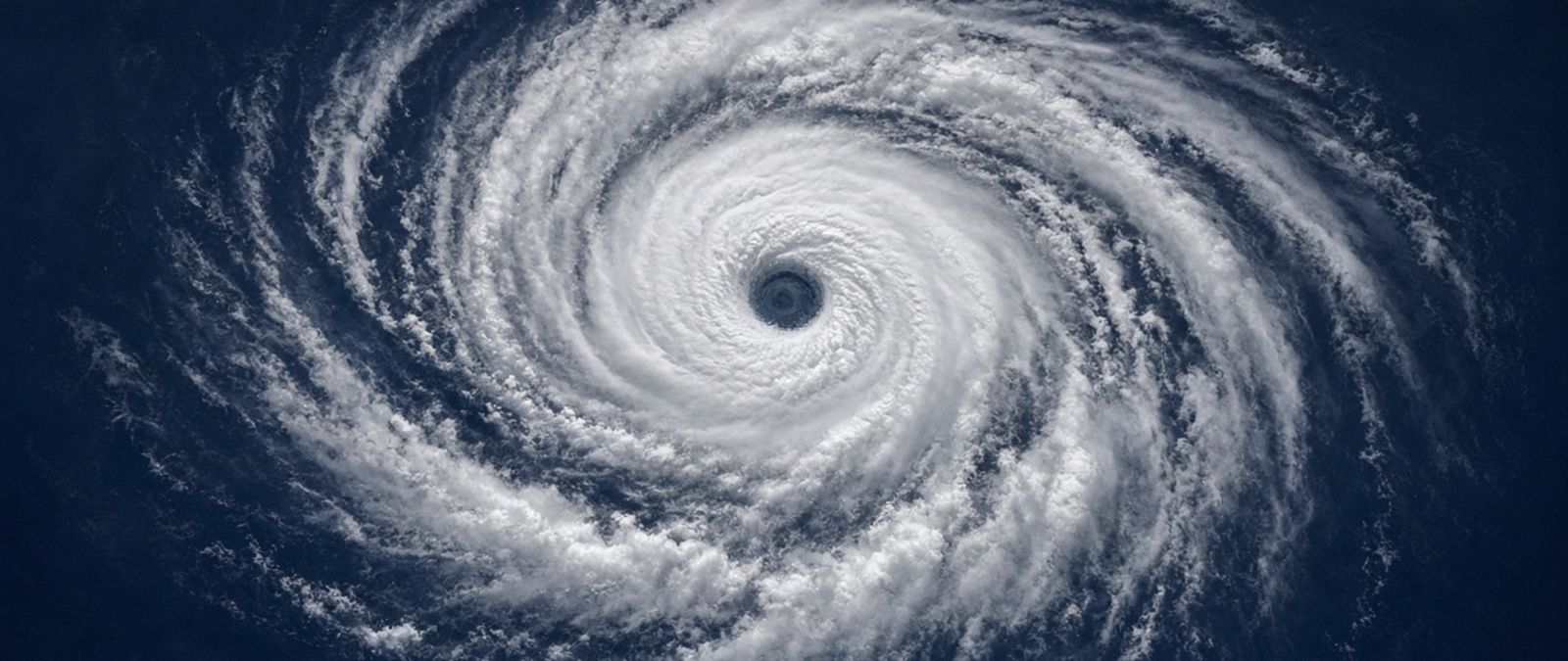
Typhoon Champi has become a Category 5 storm again over open water, while Storm Adam has caused deadly flooding in eastern Spain and the Balearic Islands. A nor’easter threatens days of coastal flooding in the United States, drought is stranding palm oil cargoes in Borneo and Cyclone Wati has damaged a key harbour in the Cook Islands.
Champi regains super typhoon strength over the Philippine Sea after passing Guam
Now over the Philippine Sea after leaving the western Pacific, Typhoon Champi is a Category 5 super typhoon once more, the US National Weather Service said. By late Monday, Asian time, it had maximum sustained winds of about 160 miles per hour, or 258 kilometres per hour, and it was not close to any land. The storm had first reached Category 5 strength early on Sunday, about six hours after passing Guam, when the Joint Typhoon Warning Center estimated its winds at 165 miles per hour.
Recapping its approach to Guam, the centre went by about 12 miles south of the island’s southern tip on Saturday, and the northern eyewall only grazed it, sparing Guam catastrophic wind damage. A cycle in which the eyewall rebuilt itself then cut Champi’s winds to around 140 miles per hour on Sunday. Forecasters expect it to head west-northwest this week over very warm seas of 29 to 30 degrees Celsius and to approach Taiwan by the weekend.
Champi began as a tropical depression that the Japan Meteorological Agency identified near Micronesia on October 11, and it was named a day later. It is one of more than two dozen named storms in a busy western Pacific season, which included Typhoon Sinlaku in April, blamed for 17 deaths and more than $1.5 billion in damage in the Mariana Islands. Earlier in the year forecasters had expected the Pacific to move from neutral conditions towards an El Niño phase in the second half of 2026.
Storm Adam leaves at least two dead as floods hit eastern Spain and the Balearic Islands
At least two people have died as Storm Adam brought torrential rain and flooding to eastern Spain, the authorities said on Monday. One death was reported in Sagunto, in the Valencia region, and Catalan firefighters found the body of a woman who had fallen into a stream near Barcelona. Valencia’s emergency chief, Juan Carlos Valderrama, told residents that travel by road was impossible and that they had to stay at home. Prime Minister Pedro Sánchez called the situation in the region very difficult.
The national weather agency AEMET issued its highest red alert for Valencia and Mallorca, and soldiers from the military emergency unit helped evacuate people, some of them stranded on rooftops. In the Balearic Islands, regional emergency services recorded around 130 incidents from Saturday night to early Monday, schools on Mallorca, Ibiza and Formentera were closed and flights were cancelled or delayed at Ibiza and Palma airports. Almost 195 litres of rain per square metre fell on Formentera in 24 hours.
The flooding revives memories of October 29, 2024, when an isolated high-altitude low, known in Spain as a DANA, dumped more than a year’s worth of rain on parts of the east of the country. About 241 people died, most of them in the Valencia region, and total damage reached about 10.7 billion euros. Criticism of the official response led the then Valencian regional president, Carlos Mazón, to resign in November 2025. Scientists say warmer seas are making these autumn storms more intense.
Slow-moving nor’easter set to bring days of coastal flooding to the US East Coast
A nor’easter forming over the Atlantic is expected to bring high surf, rip currents, coastal flooding and strong winds to parts of the eastern United States for several days this week, forecasters said on Monday. Coastal flood alerts are in force for parts of North Carolina and Virginia, where water could rise between one and four feet above normally dry ground. The National Hurricane Center is watching the system, which could become a tropical or subtropical storm named Josephine.
Forecasters said the storm should be weaker than the nor’easter that struck in late September but could linger for much of the week, stretching out its effects. The longest impacts are expected from the Delmarva Peninsula to eastern North Carolina, including the Outer Banks, with gusts of up to 45 miles per hour, beach erosion and patches of flooding. Most of the heavy rain should stay offshore, while computer models still disagree about how long the low will sit near the coast.
A nor’easter is a large storm system of the western North Atlantic that forms outside the tropics and draws its name from the strong north-easterly winds it drives onto the coast. The word has been used for centuries along the New England shoreline, where sailors dated events from storms such as one in December 1778 that drove the brig General Arnold aground near Plymouth. These systems can bring blizzards in winter, as in January 2018, and coastal flooding and erosion in autumn.
Drought shrinks Borneo’s Kapuas River and strands Indonesian palm oil harvests
A prolonged drought linked to unusually strong El Niño conditions has lowered the Kapuas River in Indonesia’s West Kalimantan province, stranding barges and leaving thousands of smallholder farmers unable to sell their palm fruit. Mills have cut purchases because their tanks are full of oil they cannot ship. One farmer, Supendi, said he waited four days at a mill in Sanggau with seven tonnes of fruit before being turned away. Sandbanks have appeared in the river, and several barges and tugs have run aground.
Thirteen of the province’s 50 mills, about half its processing capacity, are affected, said Aris Supratman of the Indonesian Palm Oil Association, who expects provincial supply to fall about 11% in September. The association has cut its national forecast by 2.9%. One mill manager said purchases fell from 30,000 tonnes in July to 10,000 in September, and that trucks are slower and cost three times as much as barges. Some farmers have cut fertiliser use by up to 70%.
The Kapuas runs 1,143 kilometres from the Müller mountains to the South China Sea near Pontianak, the provincial capital, making it the longest river in Indonesia and on Borneo, and one of the longest rivers on any island. It drops only about 50 metres over its last 902 kilometres, and in normal conditions boats with a draught of up to two metres can travel inland as far as Putussibau. The weather agency expects the rainy season to start in November, a month late.
Cyclone Wati damages Aitutaki’s main harbour as it sweeps through the Cook Islands
Tropical Cyclone Wati has partly destroyed the main port of Aitutaki as it moved through the southern Cook Islands, according to the island’s mayor, Nick Henry. He said the causeway of the new Arutanga Harbour and Marina, which received more than $7 million in strengthening and upgrades, had been found under water. He expected that the basin would have to be dredged again and that about half the causeway might have washed back into it. The port supplies the island with food and fuel.
Henry said the original funding had not covered steel sheet piling that might have made the structure more resistant to a cyclone, and that the island had already asked Rarotonga for help. Outside the marina damage was minor, affecting some boats and properties, and no injuries had been reported by mid-afternoon. The meteorological office forecast storm-force winds of 100 to 141 kilometres per hour and heavy swells, and a resident said waves reaching two storeys high were breaking on the reef.
Aitutaki is the second most populous island of the Cook Islands after Rarotonga, with 1,782 residents in 2021, and the second most visited by tourists. It is often described as an almost atoll, with 15 islets in a lagoon beside a main island whose highest point is about 123 metres. Its main village, Arutanga, lies on the west coast, and the island is linked to the rest of the country by its airport and the port. Cyclone Pat struck the island in February 2010.