
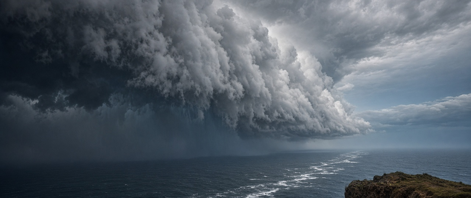
A powerful typhoon has narrowly missed Guam, a hurricane is moving along Mexico’s Pacific coast, wildfires driven by hot desert winds have destroyed homes in Southern California, a nor’easter has forced visitors off North Carolina’s Outer Banks, England’s drought has prolonged a hosepipe ban and shrunk Halloween pumpkins, the UK still awaits its first named storm, Nepal seeks help after deadly floods and storms have battered central Australia.
Typhoon Champi passes just south of Guam as a Category 4 storm
Typhoon Champi swept past the southern tip of Guam early on Sunday local time as a Category 4 storm with maximum sustained winds of 140 miles per hour, sparing the Pacific island the direct hit that forecasters had feared. A warning coordinator at the National Weather Service office on the island described the passage as a near miss, saying the centre of the storm had gone by about ten miles south of the village of Malesso’ and some 21 miles south of central Guam, moving west at around 14 miles per hour. He said the storm would leave the area as quickly as it had arrived, and that tropical storm conditions could ease as early as Sunday afternoon. Strong gusts had kept the most violent winds away from the island, he added, urging residents to be thankful that it had avoided a major strike.
In the hours before the closest approach, forecasters issued an extreme wind warning for the southern villages of Talo’fo’fo’, Inalåhan, Malesso’, Sånta Rita-Sumai and Humåtak, warning of destructive winds of 115 to 135 miles per hour that could cause significant to catastrophic damage, particularly to buildings not made of concrete. Residents were told to shelter in reinforced interior rooms away from windows and, if they were not in a concrete building, to protect themselves under sturdy furniture. Officials said winds of typhoon strength extended up to 60 miles from the centre of the storm and tropical storm winds up to 125 miles. Central Guam was expected to see winds equivalent to a Category 1 or 2 storm and the north of the island Category 1 winds, with peak conditions lasting through the late morning.
Champi strengthened very quickly as it approached the Mariana Islands. On Saturday morning the weather service still put its sustained winds at 85 miles per hour, and forecasters at the Joint Typhoon Warning Center expected them to reach about 121 miles per hour by early Sunday, before peaking at around 155 miles per hour on Monday as the storm moves away over open water. By Saturday night it had become a Category 4 storm about 55 miles southeast of the island. Typhoon warnings were in force for Guam and Rota, while Tinian and Saipan in the Northern Mariana Islands were under a tropical storm warning and typhoon watch. The weather service later said Saipan and Tinian had an easy pass and dropped flash flood watches there. Forecasters said a landfall on Guam would have been rare because of the island’s small size.
Authorities prepared for a serious blow. The governors of Guam and the Northern Mariana Islands both asked on Friday for emergency disaster declarations, which would allow federal support and funding for protective measures if approved by the US president. Airports, harbours and some health facilities were closed, and the Federal Emergency Management Agency said on Saturday that help from the mainland might take between three and five days to arrive. Guam’s governor, Lou Leon Guerrero, advised people going to public shelters to bring enough food and water for seven days. American military installations across Guam and the Marianas, including Andersen Air Force Base, moved to the highest state of storm readiness, meaning that winds of at least tropical storm force were expected within 12 hours, and service personnel took shelter.
The territories are still recovering from two earlier super typhoons, Sinlaku and Bavi, which struck in April and July. Meteorologists have linked this year’s string of intense Pacific storms to a strengthening El Niño, the periodic warming of the tropical Pacific Ocean that tends to boost cyclone activity in parts of the basin. A series of powerful systems has also made the 2026 hurricane season in the eastern Pacific the most energetic on record, according to one forecasting service. Forecasters said Champi could become one of the strongest storms in any ocean basin this year as it continued to intensify after leaving the islands behind. Officials on Guam told residents to remain indoors even after the closest approach, because winds of typhoon strength were expected to continue for some time afterwards.
Hurricane Trudy threatens heavy rain and flooding on Mexico’s Pacific coast
Hurricane Trudy kept its strength on Saturday as it moved towards Mexico’s western coast, and forecasters warned that it could strengthen further before it begins to weaken on Sunday. A hurricane warning was in force from Manzanillo in the state of Colima to Cabo Corrientes in Jalisco. The US National Hurricane Center said that early on Saturday the storm was about 305 kilometres south-southeast of Manzanillo, with maximum sustained winds of 150 kilometres an hour, making it a Category 1 hurricane. It was moving northwest at about 13 kilometres an hour and was forecast to near the southwest and west-centre of the country later on Saturday and to skirt the coastline overnight into Sunday. Hurricane conditions were expected in the warning area on Saturday night, with tropical storm conditions spreading across the region during the day.
Rain is the main danger. The hurricane centre said Trudy could bring between 10 and 20 centimetres of rain across parts of Michoacán, Colima and Jalisco through the weekend, with isolated totals of about 38 centimetres, raising the risk of life-threatening flooding and landslides, particularly in steep terrain. Its outer bands could deliver five to ten centimetres of rain, and up to 15 centimetres in places, in the states of Guerrero and Nayarit, where localised flash flooding was possible. Forecasters also warned of coastal flooding from storm surge where winds blow onshore, accompanied by large and destructive waves. Swells generated by the hurricane were already reaching parts of the southwestern coast and were expected to spread north along the west-central coast during the weekend, producing life-threatening surf and dangerous rip currents.
Mexico’s navy urged sailors and people living along the coast to take extreme care given the big waves, intense rainfall and the danger that rivers could swell and trigger floods and landslides in exposed places. Authorities in Colima said the overall risk remained low for now, but warned that heavy rainfall could still cause damage because a run of storms along the Pacific coast in recent weeks had left the ground saturated. On Friday night the storm was about 385 kilometres west-southwest of Acapulco, in Guerrero state, and about 345 kilometres south-southeast of Manzanillo, moving slowly northwest while holding winds of 150 kilometres an hour. The storm’s centre was expected to come close to the shore on Saturday and pass near it into Sunday, with forecasters saying it could still grow stronger before then.
Trudy intensified rapidly earlier in the week, becoming a Category 3 hurricane off the Pacific coast, and forecasters at one point expected it to reach Category 4 strength before weakening near the shore. It is the tenth hurricane of the year in the eastern Pacific, in what has been an unusually active season. A direct landfall was considered unlikely as high pressure building over Mexico helped to steer the storm away from the coast, but meteorologists stressed that a powerful hurricane passing close to land can still bring dangerous coastal conditions and torrential rain. They compared its likely longer-range path with that of Hurricane Simon, an earlier storm that stalled offshore near the Baja California peninsula, and said the eventual risk would depend on the storm’s track, intensity and distance from land.
Trudy is one of several tropical systems active in the Pacific at the same time. Far to the west, Typhoon Champi strengthened into a Category 4 storm as it approached Guam, and the US territories in the Mariana Islands were placed under typhoon and tropical storm warnings. Hurricane and tropical storm warnings remained in place for parts of the Mexican coast, and forecasters advised people across the region to keep monitoring local bulletins and to follow the instructions of emergency officials. Even without a direct hit, they said, damaging winds, storm surge and heavy rain remained the most serious threats along the coast, and rainfall of between 100 and 150 millimetres could still cause flooding and mudslides in vulnerable places. Trudy was expected to begin weakening on Sunday after passing near the shore.
Wind-driven wildfires destroy homes and force thousands to flee in Southern California
A fast-moving wildfire driven by strong Santa Ana winds has damaged or destroyed homes in Orange County, south of Los Angeles, and forced about 16,000 people to leave. The Norte Fire broke out on Friday morning in San Clemente and spread to neighbouring San Juan Capistrano, growing to 465 acres by the afternoon and 570 acres, or about 2.3 square kilometres, by Saturday morning, when it was five per cent contained. A senior fire official said six homes had been damaged or destroyed and that one firefighter had suffered heat exhaustion, adding that more resources were on the way. Footage posted online showed flames tearing through homes in both communities, and a San Clemente council member said the fire had reached the edge of houses on the north side of the city. Nine schools in San Juan Capistrano were closed on Friday.
The fire was one of about ten burning across California, according to the state’s forestry and fire protection agency. In Malibu, in Los Angeles County, the Bryson Fire prompted evacuation orders across the Santa Monica Mountains and grew to 147 acres, with more than 400 firefighters tackling it and about half of it contained. Further south, the Henderson Fire in San Diego County, which began on Thursday, spread to more than 3,100 acres around the Marine Corps base at Camp Pendleton and was about 35 per cent contained by Saturday morning. The size of that blaze twice forced officials to close Interstate 5, the main motorway running the length of the US West Coast, adding hours to journeys across Southern California for many commuters on Friday.
Santa Ana winds are dry, warm gusts that blow from the interior towards the coast and normally arrive during the cooler months between late September and May. They topped 40 miles per hour in the Los Angeles area on Friday, the National Weather Service said, warning drivers to watch for debris blown on to roads. Officials said the winds had peaked on Friday but would stay dangerous into Saturday, and the weather service issued a red flag warning for several counties because strong, gusty winds combined with low humidity and dry vegetation created critical conditions for fires to spread. Temperatures were also far above normal for the time of year, with a heat advisory on the Orange County and San Diego County coast and highs of about 35C forecast for Saturday.
Because some of California’s worst wildfires have been started by power equipment, utilities now switch off electricity pre-emptively when dry winds blow. More than 118,000 customers in the state were without power on Friday, according to an outage tracking site, and tens of thousands of people had their electricity deliberately cut. The coastal cities affected by the Norte Fire are surrounded by hillsides. San Juan Capistrano, a city of about 35,000 people, is known for its horse trails and historic Spanish mission, while San Clemente, home to some 62,000, is popular with beachgoers and surfers. Residents nearby described dark smoke filling the sky and the constant noise of fire engines and helicopters overhead, and one assisted living home kept two buses on standby in case it had to evacuate.
The Norte Fire was first reported at about 11:30 on Friday morning and grew from about ten acres to between 50 and 70 acres within an hour, driven by the wind and the steep terrain. By Friday evening about 6,000 homes and 16,000 residents were under evacuation orders, the county fire authority said. Some 400 firefighters were on the lines on Friday evening, with another 400 on the way, and crews worked through the night. Officials said two firefighters had been taken to hospital, one with significant injuries. In San Juan Capistrano, large homes on the hillsides burned and flames reached the back gardens of other houses, with four homes damaged on a single street. Officials said water supplies were not a problem, but asked residents to conserve water as a precaution.
Nor’easter brings flooding threat to North Carolina’s Outer Banks as visitors are ordered out
A developing nor’easter has prompted authorities in North Carolina to order all visitors off Hatteras Island and to warn that the Outer Banks could be cut off for days. Dare County declared a state of emergency for the island and issued a mandatory evacuation order for visitors from 8pm on Friday, covering the villages of Rodanthe, Waves, Salvo, Avon, Buxton, Frisco and Hatteras. Residents and areas north of Oregon Inlet were not ordered to leave. County officials said just before noon on Saturday that visitors who had not yet left must do so immediately because the window to depart safely was closing fast. Long queues formed for a ferry leaving Ocracoke Island on Saturday morning, and the Hatteras to Ocracoke ferry was later suspended until further notice because of the weather.
The National Weather Service office at Newport and Morehead City upgraded coastal flood watches to warnings for Hatteras and Ocracoke islands, saying the storm was increasingly likely to be a long event, with the worst coastal flooding expected during the high tides on Sunday and Monday. Moderate flooding on the ocean side of the islands was likely and major flooding possible in places, with water reaching up to four feet above ground level, along with significant beach erosion and dangerous surf. A high surf advisory warned of breaking waves of up to 14 feet along the shore. Forecasters said people on the two islands should prepare to be stranded for several days, warning that isolation could become life-threatening in an emergency, and state emergency managers said the effects could last into next week.
Crews worked through Saturday to reinforce sand dunes protecting Highway 12, the only road running along the islands, north of Hatteras at Pea Island. A front loader pushed sand to strengthen a dune just south of the Marc Basnight Bridge, and the work held back the sea during the early afternoon high tide, although concerns remained as the storm grew stronger. County officials said that prolonged coastal flooding and repeated waves washing over the road would probably close the highway on Hatteras Island for an extended period. The state transport department warned that coastal roads could face heavy wind, rain and overwash. Flooding on the side of the islands facing Pamlico Sound could also begin on Saturday evening, with the highest levels on Sunday and Monday, forecasters said.
The storm is forming along the same cold front that brought rain, wind and cooler air to the eastern United States, and is expected to develop along the Carolina coast later on Sunday before stalling, bringing persistent coastal flooding and erosion through the middle of the week. Coastal flood alerts extended from Morehead City through the Outer Banks and into parts of coastal Virginia and Maryland, including Kitty Hawk, Virginia Beach and Ocean City, with minor to moderate flooding possible at high tide until at least Monday evening. Wind advisories covered parts of eastern North Carolina, where gusts of up to 50 miles per hour were possible, and waves of eight to 15 feet could break along the Outer Banks and the Delmarva peninsula, according to forecasters.
The evacuation order is unusual. Mandatory evacuations of Hatteras Island have historically been linked to hurricanes and tropical storms rather than nor’easters, and a local news outlet said Friday’s announcement appeared to be the first time Dare County had ordered visitors off the island specifically ahead of such a storm, although that had not been confirmed with officials. The stretch of coast is the same one that has produced striking images of houses collapsing into the sea during earlier spells of rough surf and coastal flooding. On Friday, forecasters had already warned of up to four feet of flooding, gusts of 45 to 55 miles per hour and breaking waves of eight to 12 feet along the beaches, and the county urged visitors to follow instructions from their accommodation providers.
Thames Water extends hosepipe ban through autumn as drought shrinks Halloween pumpkins
A hosepipe ban affecting more than ten million Thames Water customers in southern England will remain in force throughout the autumn, the company has said, because its reservoirs are still far below the levels normally expected in October. The ban, first imposed on 23 July, means hosepipes and pressure washers must not be used to water gardens, wash cars, fill paddling pools or swimming pools, or clean windows, although there are exemptions for agriculture, animal welfare and customers deemed vulnerable. The utility said recent showers had brought a more autumnal feel but had not reversed the effects of a record-breaking summer and the drought that followed. A manager responsible for reducing demand urged customers to take shorter showers and turn off taps, saying small changes would make a real difference across millions of homes and businesses.
The company said rainfall across its region in September was half the long-term average, and that by 6 October the region had received only one per cent of its normal monthly rainfall for October. As a result, it said, the ground was at its driest since 2001, groundwater levels were low and river flows were below average. By 6 October, Farmoor Reservoir near Oxford was 68 per cent full and London’s reservoirs held 54 per cent of their capacity. The company stressed that cooler and darker evenings did not mean the drought was over, and said substantial rainfall would be needed to replenish supplies before the ban could be lifted. Exceptionally low reservoir levels have led the Environment Agency to declare severe drought in parts of southern England, according to forecasters.
When the ban began in July, the company said its region had received only 40 per cent of normal rainfall for the time of year and had recorded most days at or above 34C since records began. Its director of strategic water resources said then that a lack of rain combined with higher demand meant water had to be protected for essential use. A river campaign group called the ban outrageous and accused the company of losing hundreds of millions of litres of treated water through leaks every day, to which the company replied that it was investing 20 billion pounds over five years and fixing about 750 leaks a week. It said it would rely on customers to act responsibly rather than patrolling, and confirmed that hosepipe bans do not entitle customers to compensation.
The drought is also being felt at Halloween. Experts have warned that pumpkins will be noticeably smaller and in shorter supply this year, and some have suggested that people draw faces on vegetables rather than carve them. England has endured a punishing drought for most of the year, and data suggests 2026 could bring the worst harvest on record as farmers struggled to water their crops. Pumpkins are about 90 per cent water and need a great deal of it to grow. The chief horticulturalist at the Royal Horticultural Society said the crop was small unless heavily watered, adding that drought stress and late heat had made the fruit ripen earlier than usual, although it should store well because its dry matter and rind hardness were excellent.
The founder of an organic vegetable box company said it was unsurprising that pumpkins were small after such a hot, dry summer, and questioned the fashion for giant carving pumpkins that are thrown away after the festival, describing it as wasteful. He has been growing a selection of small, colourful squashes instead and urged people to paint a face on one and then eat it. Carving vegetables at Halloween began in Britain in the 17th century, when turnips, celeriac and mangelwurzels were cut into grotesque faces during celebrations linked to the Celtic festival of Samhain. Gardeners at the society’s Harlow Carr garden in North Yorkshire have even tried growing pumpkins in a compost mixture to help them cope with heavy clay soil during the dry conditions.
UK still waiting for its first named storm as forecasters expect wetter and windier weather
With November approaching, the United Kingdom has yet to see its first named storm of the season, as deep Atlantic low pressure systems have been steered away by dominant areas of high pressure. Instead, this year’s weather headlines have focused on worsening drought rather than gales. Forecasters say the jet stream, the narrow band of fast winds high in the atmosphere that delivers stormy weather to the country, has often been positioned to the north or northwest of the UK this autumn. That has brought southerly or southwesterly winds with warmer than normal conditions and allowed high pressure to dominate, reducing rainfall for many areas. As a result there have been only occasional spells of stronger winds in the northwest, with little disruption across the country so far this season.
The heaviest rain has fallen in Scotland and Northern Ireland, while parts of England and Wales have stayed much drier than normal. Parts of Herefordshire, for example, have received only a tenth of the rain they would normally expect by the middle of October. The greatest effects of the dry weather have been in southern England, where exceptionally low reservoir levels have led the Environment Agency to declare severe drought in some areas. However, forecasters expect a change in the position and strength of the jet stream during the coming week, allowing deeper low pressure systems to reach more of the country and bringing more widespread wet and windy weather. They say there is a chance of the first spell of widely disruptive weather of the season later in the week.
Longer-range forecasts also point to a stormier end to the year. The Met Office’s three-month outlook for October, November and December gives double the usual chance of wetter weather and 1.3 times the usual chance of windier weather, a pattern consistent with previous El Niño events. The Pacific warming phenomenon has been strengthening to record levels this year, and the national weather service has said the odds are rising that the weather will become wetter and windier in late autumn and early winter as a result. Forecasters have described the current calm as possibly the quiet before the storms, while cautioning that the forecasts will need to be watched closely over the coming days as the jet stream shifts and pressure patterns change across the Atlantic.
Names are mostly given when forecasters expect winds strong enough to cause damage, though heavy rain that may flood or snow that may disrupt travel can also qualify. The UK, Ireland and the Netherlands form one of five storm naming groups in Europe, with the Met Office, Ireland’s Met Éireann and the Dutch meteorological institute KNMI naming systems according to their expected impact and likelihood. In practice a name is usually assigned when a system threatens enough disruption or damage to justify an amber or red warning. Analysis of the eleven seasons since naming began in 2015 shows that named storms are much less common in spring and early summer, and May is the only month that has never had one. Storminess increases from late summer through autumn and usually peaks in December, January and February.
It is not unusual to still be waiting for the first storm at this point in the year: in about half of the seasons since 2015, the first named storm arrived after 1 November. The list of names for the 2026 to 2027 season, released at the start of September, begins with Austen, Boelo and Chloe, followed by Dano and Evelyn. The names were drawn from suggestions made by the public, after more than 40,000 nominations were submitted to the three agencies in 2025. Austen honours Austen Nagle, the first director of the Irish meteorological service, while Chloe was chosen by the Met Office after being nominated more than 130 times. The naming season begins each September, reflecting the rising chance of storms from late summer onwards.
UN official calls Nepal’s deadly floods a defining moment for climate action
Nepal’s devastating floods should be a turning point for global action on climate change, with the international community helping the Himalayan country to recover, a senior United Nations official said on Saturday. Jorge Moreira da Silva, who heads the UN Office for Project Services, an agency that carries out humanitarian and development projects, said during a visit to Kathmandu that he had seen massive devastation in the communities affected. Nepal suffered one of the worst disasters in its history on 26 August, when a mountain collapse near the border with China unleashed floods that left more than 1,400 people dead and over 5,000 unaccounted for. Scientists have said climate change played a significant role in the disaster. He described the moment as defining not only for Nepal but for the international community as a whole.
Mr Moreira da Silva said it was unfair to ask a country that emits almost no carbon dioxide to bear alone the cost of something it had not caused, and argued that global solidarity was essential. Nepal, a mostly rural nation of 30 million, produces only a tiny share of the world’s greenhouse gases, and it estimates that reconstruction will cost 4.78 billion dollars. He said rebuilding and the resettlement of displaced people must take account of future climate risks, and that the international community must renew its commitment on climate. Calling it a question of climate justice and responsibility, he warned that countries with low emissions would continue to suffer the worst effects unless the largest emitters changed course. The United Nations and its humanitarian partners launched an appeal for 49.6 million dollars last month.
The official, who also leads the UN task force on the Strait of Hormuz, said Nepal was rebuilding at a time when global disruptions were threatening food security. He said the simultaneous disruption of three maritime choke points, the Strait of Hormuz, the Black Sea and the Red Sea, posed a significant challenge, particularly for food supplies. Speaking at the UN last month, the Nepali prime minister, Balendra Shah, described the floods as a warning to the world about the mounting dangers of a warming climate. The UN appeal is intended to provide emergency assistance to the victims of the floods. Mr Moreira da Silva said the international community had a duty to help a country that had done little to cause the warming of the planet, and that rebuilding should make communities safer against the climate risks they will face in the years ahead.
The disaster struck on the morning of Wednesday 26 August in the northern district of Rasuwa, on the border with Tibet, when a huge wall of water tore along the Trishuli River, burying buildings and damaging bridges and roads. Initial reports put the death toll in the hundreds, with hundreds more missing, and the office of Nepal’s prime minister expressed deep sorrow over the loss of life as the army carried out search and rescue operations through the night. In the first hours after the flood, officials said at least 403 foreign nationals and 93 Nepali tourists were among those reported missing, including at least 47 American visitors who had been out of contact since the water swept through the Rasuwa region. Hundreds of police officers were mobilised to help with the response that evening.
Scientists said the flood had been caused by an enormous landslide and the collapse of glacial ice high in the mountains, which released a sudden surge of water and debris down the valley. On the day of the flood, Nepali police reported 162 deaths in the affected areas, while Chinese state media reported three dead on the other side of the border. The US State Department sent a disaster response adviser to the region and pledged 500,000 dollars in assistance through Catholic Relief Services to provide emergency shelter, relief supplies, clean water and sanitation for affected communities. Nepal’s disaster management authority said the flood had been triggered by a landslide about 20 kilometres northeast of the Rasuwagadhi border post, and the US Geological Survey recorded the event as a magnitude 5.2 landslide that had first been mistakenly reported as an earthquake. Many of the missing foreigners had been travelling to or from Mount Kailash, a peak revered by Hindus. The final toll of more than 1,400 dead shows how far the disaster exceeded the first estimates.
Hail and destructive winds disrupt the Alice Springs Masters Games in central Australia
The skies opened, trees fell and competitions came to a halt, but the Alice Springs Masters Games carried on as the multi-sport event marked its 40th anniversary amid rain, hail and destructive winds in central Australia. Hail first fell on the Friday before the opening day, and on Monday a destructive storm had swept through the outback town, bringing down power lines, damaging homes and cutting power to roughly 9,000 properties. Many trees came down across the town. The weather forced organisers to cancel Tuesday’s golf competition and move Wednesday’s street party indoors to the town’s convention centre. Another storm interrupted the golf on Wednesday for about an hour, but conditions on the course improved by Thursday, after local people came together to clear it of fallen trees and debris.
Some 1,800 competitors signed up for more than 20 sports during the week. One veteran of the Games said he had never experienced anything like it, describing massive hailstones and very strong winds that brought down many trees, and said he spent most of the cancelled golf day with a chainsaw. Hail the size of golf balls fell at a cattle station southwest of Alice Springs. A swimmer who turns 89 next month said the wind was blowing hard when ice started falling into the pool, and that she had feared the swimming events would be cancelled before organisers managed to restart them. A runner from Gosford who won the Masters Mile on Wednesday said he had been struck by the sight of residents out on the streets with chainsaws clearing up after the storm.
The storms that struck on Monday afternoon were described as severe and tornado-like, with rain, hail and winds of nearly 100 kilometres an hour ripping roofs from houses, knocking down trees and power lines and covering roads with leaf litter and mud across parts of the Northern Territory. A large hotel in the town suffered extensive damage, with video showing rain driven in beneath the entrance doors and water streaming from the ceiling over the front desk. Its general manager said repairs would cost more than half a million dollars, although the guest rooms had not been affected. A local cafe threw away thousands of dollars’ worth of food after the widespread power cuts, because food safety rules meant products delivered on the day of the storm had to be discarded.
The cafe’s owner said staff had spent the day documenting the losses and pouring hundreds of litres of milk down the sink, adding that the business would also lose sales while it recovered. Businesses and residents across central Australia spent the week assessing the damage left by the storms, which tore through parts of the region at the start of the week. For many competitors, the experience became part of the story of the anniversary Games. One said the event brought large numbers of visitors into the town, who went home having seen how remarkable it was, and that everyone had wanted to keep the competition going if they could because it was such a great event for the community, and that the way the town responded had shown visitors what Alice Springs was really like.
As the Games drew to a close, competitors looked back on a week remembered as much for the town’s resilience and community spirit as for the results. Several said the response of local people to the storms had left a lasting impression, with residents out with chainsaws and saws clearing fallen trees so that events could continue. The swimmer, a former teacher in remote communities of the Northern Territory, was among the longest-standing participants, while another competitor’s wife won six gold medals in the pool despite the disruption. Repairing the damage to buildings and replacing spoiled stock will take longer, with the hotel’s repair bill alone estimated at more than half a million dollars, but organisers managed to complete most of the programme of more than 20 sports despite the cancelled golf day and the interrupted swimming events.